Landuse Mapping Myanmar
Purpose
Purposes of this page is about to
- Understand landuse in Myanmar better – Learn how different landuse types look in satellite images, and how to map them correctly.
- Know the tags used by myOSM – See what tags are commonly used when mapping landuse in Myanmar.
- Help mappers around the world – Share simple tips and best practices for mapping landuse accurately and clearly.
Landuse Mapping & Tagging
As OpenStreetMap has grown over time, people now use different tags to map land use — like landuse=*, amenity=*, leisure=*, and tourism=*.
There are still many types of land use we haven’t mapped yet. Even basic information, like residential areas (where people live), is still missing in many places.
This kind of data is very important for urban planning and for humanitarian organizations, especially during disasters. It helps them know where people live and which areas are crowded, so they can plan and respond better.
That’s why we are now focusing on mapping key land use areas using the tags commonly used by myOSM mappers. The following Key & Value are as follow.
| Key | Value | Comment | Photo |
|---|---|---|---|
| landuse=residential | Residential | A portion of land predominantly used for residential purposes. Learn more about Rual & Urban residence on this page [Building Mapping Myanmar] | 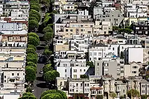 |
| amenity=hospital | Hospital | A hospital providing in-patient medical treatment. Can also map building inside hospital compound using "building=hospital" or more tips to this page [Building Mapping Myanmar] | 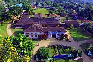 |
| landuse=religious | Religious | There are several religious types in Myanmar such as Buddhism, Christan, Hindu & Musalim etc. Most of the religious land are usually related to Buddhism in Myanmar. Local people sometimes use monasteries as disaster shelters or community gathering centers. Can also map monastery building footprint as “building=monastery” or more tips to this page [Building Mapping Myanmar] | 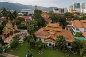 |
| amenity=school | School | People usually went for education. An elementary, middle & primary school etc. in Myanmar. Sometimes, schools are also used as disaster shelters or community gathering centers in Myanmar. Can map school building footprint as “building=school” or more tips to this page [Building Mapping Myanmar] | 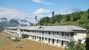 |
| leisure=pitch | Pitch | An area designed for practising a particular sport, normally designated with appropriate markings. In Myanmar, pitch can be easy spotted in rural area along with “amenity=school” which is sometimes used as community activities, sport - football activities etc. See more tips about pitch, go to this page [Building Mapping Myanmar] | 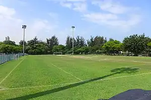 |
| landuse=farmland | Farmland | An area of farmland used for tillage (rice, cereals, vegetables, oil plants and other annual agricultural crops including flowers). | 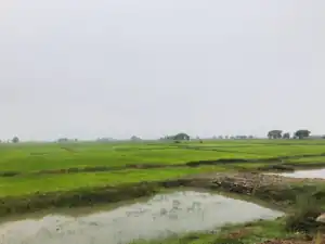 |
| landuse=orchard | Orchard | Used to mark intentional planting of trees or shrubs maintained for food production. This tag is also used for tropical plantations of perennial plants used to produce food and beverages, including tea, coffee, banana, coconut, oil palm plantations & rubber plantations. | 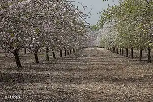 |
| landuse=forest | Forest | A forest or woodland is a natural or semi-natural area covered by trees, which may or may not be used to produce forestry products such as wood and timber. | 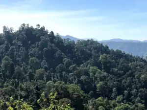 |
| landuse=industrial | Industrial | An area with predominantly workshops, factories or warehouses. | 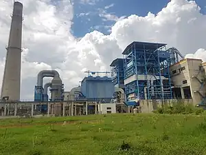 |
myOSM team will continue to update and expand the list of tags in the future to align with the Myanmar OSM landuse classification system. For reference, the original English versions of landuse classifications can be found on the OpenStreetMap Wiki at:https://wiki.openstreetmap.org/wiki/Land_use
Urban & Rural Land Use
Land use in urban and rural areas is different in Myanmar. In urban areas, land use is more complex. There are many types of land use, such as housing, markets, schools, roads, and parks. Cities are larger and need more skill to map correctly, so they are better for intermediate or advanced mappers. In rural areas, land use is simpler and easier to see in satellite images. You can often find farmland, villages, or forests. These areas are smaller and easier to map, so they are good for beginner mappers. In OpenStreetMap (OSM), myOSM does not recommend digitizing land use for analysis, because the data is not consistent and the tools are not easy to use. It can be hard to draw land use areas correctly. However, in some cases, land use mapping is still useful. It can help people understand which parts of a town are covered by different types of land, like forest or farmland. You can see this in example places across Myanmar.
For rural land use, myOSM will pilot suitable areas, which will be identified and updated on the map accordingly. [In progress]
myOSM's JOSM Useful Mapping Tips
Use the following shortcut to easily map on JOSM. Which will help mapper to quick & more accurate building data.
- Use the keyboard shortcut “A” to make an easy node/digitize.
- Use the keyboard shortcut “S” to activate the select tool.
- Press “B” in Keyboard & click one corner of the building, then drag to the opposite corner. (Building Tool Plugin)
- if same size buildings are scatter, digitize one building footprint & copy (“Ctrl + C”) & paste (“Ctrl + V”) it on the building
- If you want to “match (or) aligns” with existing building footprint, select existing building footprint using shortcut “S”, then press “B” and drag to one corner (Align with other building)
- If you want to draw complex building footprint, digitize multiple building footprint & combine (“Shift + J”)
- Press “Ctrl” to avoid snapping to other features such as road, landuse etc.
- press “Q” for a quick rectangle/square.
- “Shift + Ctrl” to rotate the building features.
- "Ctrl + Alt" to Shrink/Enlarge (Resize) features.
- Use the keyboard shortcut “X” to extrude, four side rectangle to orthogonal building.