MUTCD/Michigan/D
Series D of the Michigan Manual on Uniform Traffic Control Devices is for directional signs. The following tables display only the signs specific to the sign manual in Michigan, including signs using the Clearview typeface for text; consult MUTCD/D for directional signs in the national standard.
D1: Destination
| Sign or plaque | Designation | Name | Tags | Notes |
|---|---|---|---|---|
| D1-1 | Destination (1 line) | |||
| D1-1a | Destination and Distance (1 line) | |||
| D1-1b | Road Name With Angled Arrow (1 Line) | |||
| File:MUTCD-MI D1-1c.svg | D1-1c | Road Name With Angled Arrow (2 Lines) | ||
| File:MUTCD-MI D1-1d.svg | D1-1d | Route Directional Destination and Angled Arrow | ||
| File:MUTCD-MI D1-2.svg | D1-2 | Destination (2 lines) | ||
| File:MUTCD-MI D1-2a.svg | D1-2a | Destination and Distance (2 lines) | ||
| File:MUTCD-MI D1-2b.svg | D1-2b | Double destination | ||
| File:MUTCD-MI D1-2c.svg | D1-2c | Roundabout Arrow with Destination and Destination with Arrow | ||
| File:MUTCD-MI D1-2d.svg | D1-2d | Arrow With Destination and Roundabout Arrow With Destination | ||
| File:MUTCD-MI D1-3.svg | D1-3 | Destination (3 lines) | ||
| File:MUTCD-MI D1-3a.svg | D1-3a | Destination and Distance (3 lines) | ||
| File:MUTCD-MI D1-3b.svg | D1-3b | Double Destination land Single Destination | ||
| File:MUTCD-MI D1-3c.svg | D1-3c | Destination with Roundabout Arrow (3 Lines) | ||
| File:MUTCD-MI D1-3d.svg | D1-3d | Roundabout Double ^Destination and Destination with Arrow |
D2: Distance
| Sign or plaque | Designation | Name | Tags | Notes |
|---|---|---|---|---|
| File:MUTCD-MI D2-1.svg | D2-1 | Distance (1 line) | ||
| File:MUTCD-MI D2-2.svg | D2-2 | Distance (2 lines) | ||
| File:MUTCD-MI D2-3.svg | D2-3 | Distance (3 lines) |
D3: Street Name
| Sign or plaque | Designation | Name | Tags | Notes |
|---|---|---|---|---|
| D3-1 | Street Name | |||
| D3-2 | Advance Street Name | |||
| File:MUTCD-MI D3-2a.svg | D3-2a | Advance Street Name with Arrrow | ||
| File:MUTCD-MI D3-2b.svg | D3-2b | Destination and Advance Street Name | ||
| File:MUTCD-MI D3-2c.svg | D3-2c | Double Advance Street Names with Arrrows | ||
| File:MUTCD-MI D3-2d.svg | D3-2d | Advance Street Name with Arrrow (Two Lines) | ||
| File:MUTCD-MI D3-2e.svg | D3-2e | Advance Street Name | ||
| File:MUTCD-MI D3-2f.svg | D3-2f | Advance Street Name (With Arrow) | ||
| File:MUTCD-MI D3-2g.svg | D3-2g | Advance Street Name (Destination with Arrow and Street Name) | ||
| File:MUTCD-MI D3-2h.svg | D3-2h | Advance Street Name (Double with Arrows) | ||
| File:MUTCD-MI D3-2i.svg | D3-2i | Advance Street Name (Double) | ||
| File:MUTCD-MI D3-2j.svg | D3-2j | Advance Street Name (With Single Cardinal Direction) | ||
| File:MUTCD-MI D3-2k.svg | D3-2k | Advance Street Name (With Double Cardinal Directions) | ||
| File:MUTCD-MI D3-2m.svg | D3-2m | Advance Street Name (With Route Marker) |
D4: Parking
| Sign or plaque | Designation | Name | Tags | Notes |
|---|---|---|---|---|
| File:MUTCD-MI D4-1.svg | D4-1 | Parking With Arrow | ||
| File:MUTCD-MI D4-2a.svg | D4-2a | Park and Ride (Next) | ||
| File:MUTCD-MI D4-2b.svg | D4-2b | Park and Ride (Exit) | ||
| File:MUTCD-MI D4-2c.svg | D4-2c | MDOT Carpool Parking (Next), Supplemental Panel 1 and 2 | ||
| File:MUTCD-MI D4-2d.svg | D4-2d | Local Transit Carpool Parking (Next), Supplemental Panel 1 and 2 | ||

|
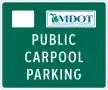
D4-4 | MDOT Public Carpool Parking | ||
|
D4-4a | Local Transit and MDOT Public Carpool Parking | ||
| File:MUTCD-MI D4-4b.svg | D4-4b | MDOT Public Carpool Parking with Arrow | ||
|
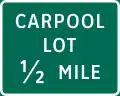
D4-4c | Carpool Lot Distance |
D5: Rest Area
| Sign or plaque | Designation | Name | Tags | Notes |
|---|---|---|---|---|
| File:MUTCD-MI D5-1a (REST AREA).svg | D5-1a | Rest Area Distance (Freeway) | ||
| File:MUTCD-MI D5-1a (PARKING AREA).svg | Parking Area Distance (Freeway) | |||
| File:MUTCD-MI D5-1b (PARKING AREA).svg | D5-1b | Parking Area Distance (Non-freeway) | ||
| File:MUTCD-MI D5-1b (REST AREA).svg | Rest Area Distance (Non-freeway) | |||
| File:MUTCD-MI D5-1c.svg | D5-1c | Michigan Welcome Center Distance | ||
| File:MUTCD-MI D5-2 (REST AREA).svg | D5-2 | Rest Area (with arrow) | ||
| File:MUTCD-MI D5-2 (PARKING AREA).svg | Parking Area (with arrow) | |||
.svg.png)
|
D5-2a | Rest Area Gore | ||
.svg.png)
|
Parking Area Gore | |||
| File:MUTCD-MI D5-2c.svg | D5-2c | Michigan Welcome Center with Arrow | ||
| File:MUTCD-MI D5-3a.svg | D5-3a | Truck Parking Exit | ||
| File:MUTCD-MI D5-3b.svg | D5-3b | Truck Parking | ||
| File:MUTCD-MI D5-5.svg | D5-5 | Rest Area (with Horizontal Arrow) | ||

|
D5-5a | Roadside Table Symbol | ||
| File:MUTCD-MI D5-5f.svg | D5-5f | Dog Run (with Horizontal Arrow) | ||
| File:MUTCD-MI D5-5g.svg | D5-5g | Litter Barrel | ||
| File:MUTCD-MI D5-6aP.svg | D5-6aP | Next Area Distance Panel |
D6: Roadside Park
| Sign or plaque | Designation | Name | Tags | Notes |
|---|---|---|---|---|
| File:MUTCD-MI D6-1.svg | D6-1 | Roadside Park Arrow | ||
| File:MUTCD-MI D6-2.svg | D6-2 | Roadside Park Distance | ||
| File:MUTCD-MI D6-3.svg | D6-3 | Roadside Park with Angled Arrow |
D7: Recreation Area
| Sign or plaque | Designation | Name | Tags | Notes |
|---|---|---|---|---|
| File:MUTCD-MI D7-1.svg | D7-1 | Recreation Area Distance Sign | ||
| File:MUTCD-MI D7-1a.svg | D7-1a | Recreation Area Direction Sign (Two Lines) | ||
| File:MUTCD-MI D7-1b.svg | D7-1b | Recreation Area Direction Sign (Three Lines) | ||
| File:MUTCD-MI D7-1c.svg | D7-1c | Recreation Area Symbol Direction Sign (One Line) | ||
| File:MUTCD-MI D7-1d.svg | D7-1d | Recreation Area Symbol Direction Sign (Two Lines) |
D8: Weigh Station
| Sign or plaque | Designation | Name | Tags | Notes |
|---|---|---|---|---|
| File:MUTCD-MI D8-1.svg | D8-1 | Weigh Station Distance | ||
| File:MUTCD-MI D8-2.svg | D8-2 | Weigh Station Right Lane (Left Lane) | ||
| File:MUTCD-MI D8-2a.svg | D8-2a | Weigh Station Right Distance | ||
| File:MUTCD-MI D8-2b.svg | D8-2b | Weigh Station Left Distance | ||
| File:MUTCD-MI D8-3.svg | D8-3 | Weigh Station Angled Arrow |
D9: General Service
| Sign or plaque | Designation | Name | Tags | Notes |
|---|---|---|---|---|
| File:MUTCD-MI D9-2a.svg | D9-2a | Hospital Name and Symbol With Right (Left) Arrow | ||
| File:MUTCD-MI D9-2b.svg | D9-2b | Hospital Name and Symbol With Angled Arrow | ||
| File:MUTCD-MI D9-2c.svg | D9-2c | Hospital Name and Symbol With Up Arrow | ||
| File:MUTCD-MI D9-2d.svg | D9-2d | Hospital Plaque | ||
| File:MUTCD-MI D9-18.svg | D9-18 | Motorist Services Sign 6 Symbols Next Right | ||
| File:MUTCD-MI D9-18a.svg | D9-18a | Motorist Services Sign 6 Symbols Exit | ||
| File:MUTCD-MI D9-18b.svg | D9-18b | Motorist Services Sign 3 Symbols Next Right | ||
| File:MUTCD-MI D9-18c.svg | D9-18c | Motorist Services Sign 3 Symbols Exit | ||
| File:MUTCD-MI D9-18d.svg | D9-18d | General Services (One Line) |
D10: Reference Location
| Sign or plaque | Designation | Name | Tags | Notes |
|---|---|---|---|---|
| File:MUTCD-MI D10-1.svg | D10-1 | Reference Location (1-Digit) | ||
| File:MUTCD-MI D10-1a.svg | D10-1a | Intermediate Reference Location (1-Digit) | ||
| File:MUTCD-MI D10-2.svg | D10-2 | Reference Location (2-Digit) | ||
| File:MUTCD-MI D10-2a.svg | D10-2a | Intermediate Reference Location (2-Digit) | ||
| File:MUTCD-MI D10-3.svg | D10-3 | Reference Location (3-Digit) | ||
| File:MUTCD-MI D10-3a.svg | D10-3a | Intermediate Reference Location (3-Digit) | ||
| File:MUTCD-MI D10-4.svg | D10-4 | Enhanced Reference Location | ||
| File:MUTCD-MI D10-5.svg | D10-5 | Intermediate Enhanced Reference Location |
| Sign or plaque | Designation | Name | Tags | Notes |
|---|---|---|---|---|
| File:MUTCD-MI D11-1.svg | D11-1 | Bicycle Route | ||
| File:MUTCD-MI D11-5.svg | D11-5 | Snowmobile Route Symbol | ||
| File:MUTCD-MI D11-5a.svg | D11-5a | Combined Snowmobile Route Symbol and Panel |
D12:
| Sign or plaque | Designation | Name | Tags | Notes |
|---|---|---|---|---|
| File:MUTCD-MI D12-1.svg | D12-1 | Weather Info | ||
| File:MUTCD-MI D12-2b.svg | D12-2b | Carpool Vanpool Information | ||
| File:MUTCD-MI D12-2c.svg | D12-2c | Carpool Vanpool Bus Information | ||
| File:MUTCD-MI D12-2d.svg | D12-2d | Rideshare Info | ||

|
D12-3 | Channel 9 Monitored |
D13: Freeway Entrance
| Sign or plaque | Designation | Name | Tags | Notes |
|---|---|---|---|---|
| File:MUTCD-MI D13-2.svg | D13-2 | Crossover | ||
| File:MUTCD-MI D13-3aR.svg | D13-3aR | Freeway Entrance |
D17: Passing Lane signs
| Sign or plaque | Designation | Name | Tags | Notes |
|---|---|---|---|---|
| File:MUTCD-MI D17-1.svg | D17-1 | Next Passing Lane Distance | ||
| File:MUTCD-MI D17-2.svg | D17-2 | Passing Lane Distance | ||
| File:MUTCD-MI D17-3.svg | D17-3 | Passing Lane Ahead |