It has been proposed that this page be
deleted or replaced by a redirect. See the discussion page for further information.
The given reason is:
The development of this app was stopped. It is not available on Google Play any more. It had no significant impact on the historic development of OSM. --Nakaner (talk) 08:57, 9 October 2024 (UTC).
(Pages that link to this page.)
This page was last edited by Maro21; 00:55, 9 December 2024 (UTC) (228 days ago).
| TrekBuddy
|
|
|
| Author:
|
Ales Pour (Kruch)
|
| License:
|
Proprietary (free of charge)
|
| Platforms:
|
Java ME and Android
|
| Status:
|
Broken
|
| Version:
|
1.33 (2017-03-01)
|
| Languages:
|
English and multiple languages
|
| Website:
|
http://www.trekbuddy.net
|
| Install:
|
|
| Programming language:
|
Java
|
|
Highly customizable navigation/map display tool
|
|
Features
| Feature
|
Value
|
| Map Display
|
| Display map
|
yes
|
| Map data
|
raster
|
| Source
|
offline
|
| Rotate map
|
yes
|
| 3D view
|
no
|
| Shows website
|
?
|
| Shows phone number
|
?
|
| Shows operation hours
|
?
|
| Routing
|
| Routing
|
no
|
| Create route manually
|
?
|
| Calculate route
|
?
|
| Create route via Waypoints
|
?
|
| Routing profiles
|
?
|
| Turn restrictions
|
no
|
| Calculate route without Internet (Offline routing)
|
?
|
| Routing providers
|
?
|
| Avoid traffic
|
?
|
| Traffic Provider
|
?
|
| Navigating
|
| Navigate
|
yes
|
| Find location
|
?
|
| Find nearby POIs
|
?
|
| Navigate to point
|
?
|
| Navigation with voice / Voice guidance
|
no
|
| Keep on road
|
no
|
| Lane guidance
|
?
|
| Works without GPS
|
yes
|
| Navigate along predefined route
|
?
|
| Tracking
|
| Make track
|
yes
|
| Customizable log interval
|
yes
|
| Track formats
|
?
|
| Geotagging
|
note;photo;audio
|
| Fast POI buttons
|
no
|
| Upload GPX to OSM
|
no
|
| Monitoring
|
| Monitoring
|
yes
|
| Show current track
|
yes
|
| Open existing track
|
yes
|
| Altitude diagram
|
yes
|
| Show POD value
|
yes
|
| Satellite view
|
yes
|
| Show live NMEA data
|
no
|
| Show speed
|
?
|
| Send current position
|
no
|
| Editing
?
|
| Rendering
?
|
| Accessibility
?
|
|
|
TrekBuddy
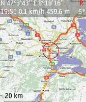
Can be downloaded from www.trekbuddy.net. Trekbuddy is a Java ME application to be used with a GPS receiver. It is designed to work with every Java-enabled device.
It features capabilities such as
- GPS tracking and simple touristic navigation
- bitmap maps without zoom, but bitmap maps can be stored with different resolutions in one package called "atlas"
- tracklogging in NMEA or GPX format
- simple navigation (to a single waypoint or along a route)
- compas screen (HPS)
- freely cutomizable cockpit screen (CMS) including calculations
- location sharing via SMS with other trekbuddies
and more.
It supports most commonly used map projections and grids, such as
- Latitude/Longitude
- Mercator
- Transverse Mercator
- Universal Transverse Mercator
- Swedish Grid
- British National Grid
- Irish Grid
- Swiss Grid
- Lambert France I-IV
- Lambert Conformal Conic
as well as custom datums.
As a location source
- Bluetooth or serial port GPS
- internal (integrated) GPS
- NMEA file
- HGE-100 device
- O2 Germany network
may be used.
Create offline maps using Mobile Atlas Creator.
See: http://www.trekbuddy.net/wiki/index.php/Main_Page