Zh-hant:Key:highway
.jpg) |
| 說明 |
|---|
| 主要的道路標籤,以及標示其重要程度。 |
| 組: 道路 |
| 用於這些元素 |
| 已記載的值: 71 |
| 暗含 |
| 常用組合 |
| 狀態:已批准 |
| 此標籤的工具 |
運用
- 主條目:Highways
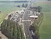
=*用作標示所有類型的道路、街道、路徑。其值標示道路在道路編制系統中的重要程度。請參閱下列表格(由最高級別的motorway)至最低級別的service排列)。
請參閱Highway:International equivalence,以了解此標籤如何應用於不同國家道路系統。
此標籤亦用於公車站、服務區、行人穿越道等道路相關圖徵(請參閱下方表格)。
範例
更多圖文範例,請參閱都市道路標記範例、郊區道路標記範例。
値
道路 (Highway)
| 鍵 (Key) | 值 (Value) | 元素 (Element) | 說明 | 圖例 | 圖片 | |
|---|---|---|---|---|---|---|
道路 | ||||||
|
下列為道路網絡的主要標籤,依重要程度由高至低排序。 | ||||||
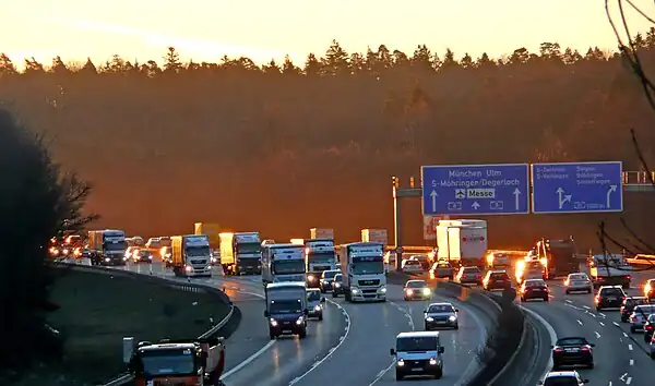
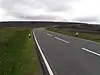
| motorway | 高速公路:雙向分隔行駛、完全控制出入口的公路,單向常設有兩條以上的車道及供緊急用途的路肩或避車彎。
|
 |
||||
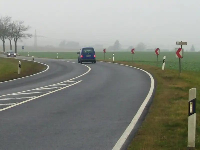
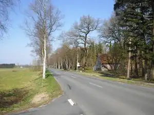
| highway | trunk | 不屬高速公路,國家管轄的重要道路(不一定為雙向分隔行駛)。
|
 |
| ||
| highway | primary | 一級道路(連接大型市鎮)
|
 |
| ||
| highway | secondary | 二級道路(連接一般市鎮)
|
 |
| ||
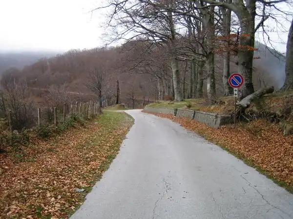
| highway | tertiary | 三級公路(連接小型聚落或大型市鎮內的衛星市郊)。
|
 |
| ||
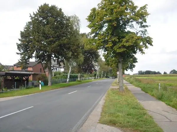
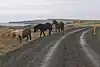
| highway | unclassified | 一般道路/無編制道路(連結村莊及聚落間):公路系統中最低層級的道路,供公共通行而非連接私人產權(請使用=residential)。公路等級未知、待分類的道路,請使用 =road。
|
 |
| ||
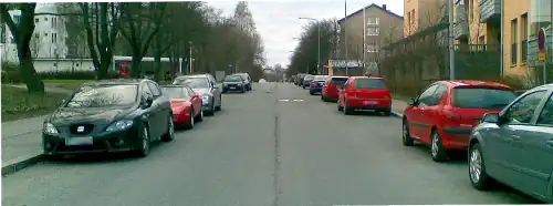
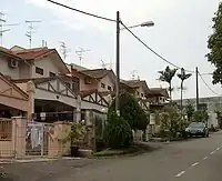
| highway | residential | 住宅區道路:進出住宅區或住宅區內的道路,並非用於穿越聚落或連接聚落的道路。 |  |
| ||
匝道 | ||||||
| highway | motorway_link | 高速公路匝道:連結不同高速公路(Interchange),或由高速公路連結較低等級的公路(Junction)。 ̈
|
 |
 | ||
| highway | trunk_link | 快速道路匝道:連結不同快速道路(Interchange),或快速道路連結較低等級的公路(Junction)。
|
 |
 | ||
| highway | primary_link | 省道匝道:連結不同主要道路,或主要道路連結較低等級的道路。 能用於道路交會處的槽化車道。 |
 |
_-_geo-en.hlipp.de_-_11914.jpg) | ||
| highway | secondary_link | 二級道路匝道。 |  |
 | ||
| highway | tertiary_link | 三級道路匝道。 |  |
|||
特定道路 | ||||||
| highway | living_street | 生活街道:行人路權高於機動車輛,設置極低的道路限速,允許幼童在街道上玩耍。 |  |
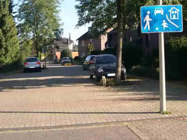 | ||
| highway | service | 服務道路:工業園區、露營地、產業園區或停車場等設施或場域的內部道路或對外聯絡道路。 搭配 |
 |
 | ||
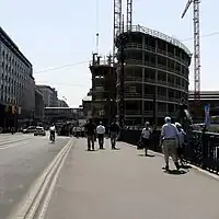
| highway | pedestrian | 人行道/行人徒步區,得用於廣場(圍成區域後加上area=yes)。
|
 |
 | ||
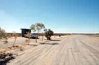
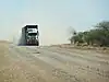
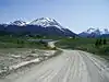
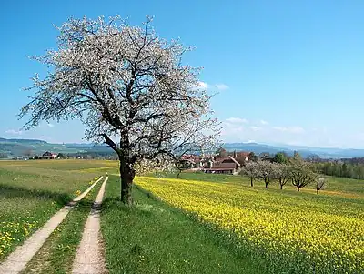
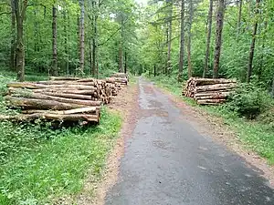
| highway | track | 農路、林道、礦路等產業道路。常鋪剛性路面(水泥/石礫)、柔性路面(碎石/壓實草地、土壤、泥地、砂地)或混合兩者。 。路面品質使用標籤 tracktype=*標記 。若您想標記一般道路,請使用general highway values。 |
 |
|||
| highway | bus_guideway | 導向巴士道,其他車輛無法使用。 注意:一般公車專用道/巴士專用線請改用 access=no, psv=yes 替代。
|
 |
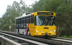 | ||
| highway | escape | 緊急避車道:供煞車失效的車輛安全緩衝減速。 | 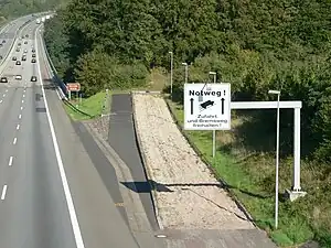 | |||
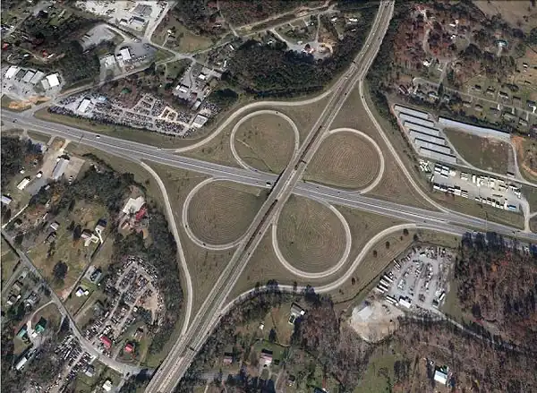
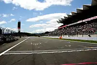
| highway | raceway | 環形賽道或賽車使用的賽道。 賽跑或賽馬用的賽道,請改用 |
 |
 | ||
| highway | road | 未知種類的道路:此暫時性標籤用以標記該道路尚未調查其種類,一旦查明應立即標記適當的種類。 若您知道該道路層級,請改用 =*。
|
 |
 | ||
| highway | busway | A dedicated roadway for bus rapid transit systems | 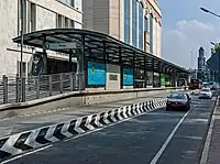 | |||
路徑(Paths) | ||||||
| footway | 步道。專為行人設計的道路,含散步小徑或碎石步道。 若允許單車通行,請加入 bicycle=yes標籤。如不清楚路徑的主要用途,請勿使用此標籤。 商店街或住宅區的人行道,請使用 =pedestrian;若人行道同時能供農業機具通行,請使用=track。
|
 |
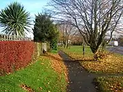 | |||
| highway | bridleway | 為馬匹設計的路徑。等同於 =path + horse=designated。
|
 |
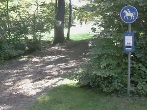 | ||
| highway | steps | 行人使用的階梯。得配合step_count=*標記階梯階數。
|
 |
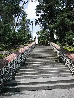 | ||
| highway | corridor | For a hallway inside of a building. |  | |||
| highway | path | 無特定用途的路徑。 |  |
 | ||
| highway | via_ferrata | A via ferrata is a route equipped with fixed cables, stemples, ladders, and bridges in order to increase ease and security for climbers. These via ferrata require equipment : climbing harness, shock absorber and two short lengths of rope, but do not require a long rope as for climbing. |  | |||
When sidewalk/crosswalk is tagged as a separate way | ||||||
| footway | sidewalk | Sidewalk that runs typically along residential road. Use in combination with =footway or =path
|
|
 | ||
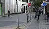
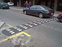
| footway | crossing | 行人穿越道,如斑馬線(枕木型行人穿越道)。 | |
 | ||
| footway | traffic_island | The way between two crossings, safespot for pedestrians, has micromapping characteristics as a detailed alternative to =*. Use in combination with =footway or =path.
|
|
|||
當公路附設人行道時(詳情請見Sidewalks) | ||||||
| sidewalk | both | left | right | no | Specifies that the highways has sidewalks on both sides, on one side or no sidewalk at all | 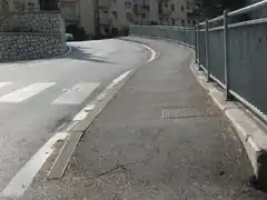 | |||
當自行車擁有專用路權時(詳情請見 Bicycle) | ||||||
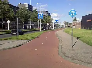
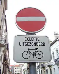
| highway | cycleway | 自行車專用道。專門為腳踏車設計的路徑。 如果未受一般進入限制管制,得加入 foot=*。
|
 |
 | ||
自行車道附設於一般道路時(詳情請見 Bicycle) | ||||||
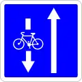
| cycleway | lane | 道路附設的自行車道。 | 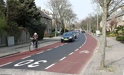 | |||
| cycleway | 允許自行車雙向通行,請使用oneway=yes 或 oneway:bycycle=no。
|
 | ||||
| cycleway | 自行車的行進方向,與道路行進方向相反時,請使用oneway=yes或oneway:bycycle=no。
|
 | ||||
| cycleway | track | 與道路分隔的自行車道。注意:常被標記為=cycleway。
|
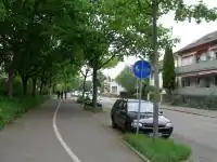 | |||
| cycleway | 與道路分隔的自行車道。自行車行進方向與道路行進方向相反時,請同時使用 oneway=yes。
|
 | ||||
| cycleway | share_busway | There is a bus lane that cyclists are permitted to use. | 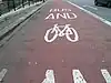 | |||
| cycleway | Deprecated variant for ways with oneway=yes that have a bus lane that cyclists are also permitted to use, and which go in the opposite direction to normal traffic flow (a "contraflow" bus lane). Replaced by oneway:bicycle=no + cycleway:left=share_busway/cycleway:right=share_busway + cycleway:left:oneway=-1/cycleway:right:oneway=-1.
|
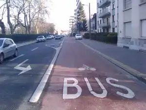 | ||||
| cycleway | shared_lane | 公車專用道允許自行車使用。 |  | |||
Busways tagged on the main roadway or lane (see Bus lanes) | ||||||
| lane | 公車專用道。 | | ||||
| opposite | Deprecated variant for ways with oneway=yes where buses are legally permitted to travel in both directions. Replaced by oneway:bus=no
|
|||||
| opposite_lane | Deprecated variant for ways with oneway=yes that have a bus lane which go in the opposite direction to normal traffic flow (a "contraflow" bus lane). Replaced by oneway:bus=no and lanes:bus=* / lanes:psv=*) / bus:lanes=* / psv:lanes=*
|
|||||
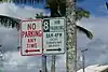
Street parking tagged on the main roadway (see Street parking) | ||||||
parking:left / :right / :both(hereafter: parking:side) |
lane | street_side | on_kerb | half_on_kerb | shoulder | no | separate | yes | Primary key to record parking along the street. Describes the parking position of parked vehicles in the street. | 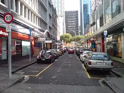 | |||
parking:sideorientation=*
|
parallel | diagonal | perpendicular | To specify the orientation of parked vehicles if there is street parking. | ||||
生命週期(Lifecycle)(see also lifecycle prefixes) | ||||||
| highway | proposed | 計畫中道路。 計畫中道路的等級使用 proposed=*標記。
|
||||
| highway | construction | 施工中道路。施工中道路的等級使用construction=*標記。
|
 |
 | ||
屬性(Attributes) | ||||||
| abutters | commercial | industrial | mixed | residential | retail etc. | 詳情參考abutters=*。
|
 | |||
| bicycle_road | yes | 若住宅區街道視同腳踏車道,使用此標籤。此類車道常擁有腳踏車專屬燈號,汽車則限速管制。 | 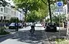 | |||
| bus_bay | both | left | right | A bus bay outside the main carriageway for boarding/alighting | 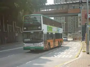 | |||
| change | yes | no | not_right | not_left | only_right | only_left | Specify the allowed/forbidden lane changes | .jpg) | |||
| destination | <place name of destination> | Destination when following a linear feature | .svg.png) | |||
| embankment | yes | dyke | A dyke or a raised bank to carry a road, railway, or canal across a low-lying or wet area. | 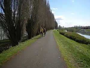 | |||
| embedded_rails | yes | <type of railway> | 公路上的軌道路軌可供一般車輛通行,軌道以獨立線段繪製。 | _heading_NW.jpg) | |||
| ford | yes | 車輛通過時須橫渡水流或溪流。 |  | |||
| frontage_road | yes | A frontage road. | ||||
| ice_road | yes | 結冰水域上的道路,夏季時無法通行。 | 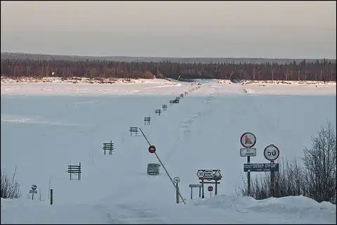 | |||
| incline | Number % | ° | up | down | 道路坡度。使用百分比(「5%」)或角度(「20°」)標示。 正數或負數標記該道路通行方向為上升或下降。 |
 | |||
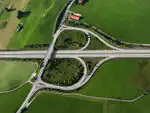
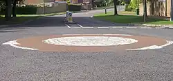
| junction | roundabout | 圓環。 自動設定為單行道 oneway=yes,單行道方向依據線(way)上點(node)的排列方向。,圓環亦同時標記為道路 =*。
|
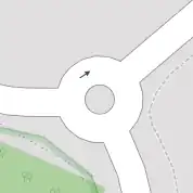 |
 | ||
| lanes | <number> | 車道數/行車綫數目。含公車或特定用途車輛的車道數。 | 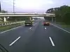 | |||
| lane_markings | yes | no | Specifies if a highway has painted markings to indicate the position of the lanes. | 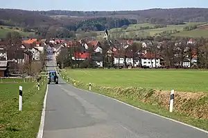 | |||
| lit | yes | no | 是否設置路燈照明。 |  | |||
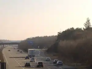
| maxspeed | <number> | Specifies the maximum legal speed limit on a road, railway or waterway. | 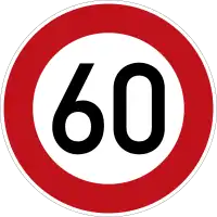 | |||
| motorroad | yes | no | 標記屬於封閉專用路權、非高速公路的道路。 | 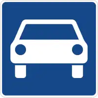 | |||
| mountain_pass | yes | 啞口、鞍部。 |  |
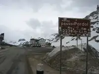 | ||
| mtb:scale | 0-6 | 搭配 =path、=track使用。標記登山、單車活動的行程難度。
|
 | |||
| mtb:scale:uphill | 0-5 | 登山車路徑的上坡分級難度。 | | |||
| mtb:scale:imba | 0-4 | 國際登山車協會界定的登山車路徑分級難度。 | ||||
| mtb:description | Text | 標示登山車路徑的行程資訊。適用於=path與=track。
|
||||
| oneway | yes | no | reversible | Oneway streets are streets where you are only allowed to drive in one direction. | 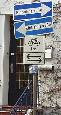 | |||
| oneway:bicycle | yes | no | | Used on ways with oneway=yes where it is legally permitted to cycle in both directions.
|
| |||
| overtaking | yes | no | caution | both | forward | backward | 標註是否為高乘載或具特殊乘載規定的車道。 |  | |||
| parallel | diagonal | perpendicular | marked | no_parking | no_stopping | fire_lane. | 停車位劃設種類。詳情參見 parking:lane=* 。
|
 | ||||
| free | ticket | disc | residents | customers | private | 停車限制。詳情參見 parking:condition=*。
|
 | ||||
| passing_places | yes | 標記會車的路段。 |  | |||
| priority | forward | backward | Traffic priority for narrow parts of roads, e.g. narrow bridges. | 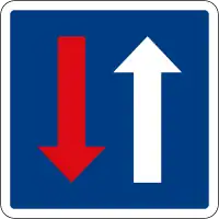 | |||
| priority_road | designated | yes_unposted | end | Specifying roads signposted as priority roads. |  | |||
| sac_scale | strolling | hiking | mountain_hiking | demanding_mountain_hiking | alpine_hiking | demanding_alpine_hiking | difficult_alpine_hiking | 標記健行路徑的行程難度。適用於=path與=footway。
|
.jpg) | |||
| service | alley | driveway | parking_aisle etc. | 詳情請見 service=*。
|
 | |||
| shoulder | no | yes | right | both | left | Presence of shoulder in highway |  | |||
| side_road | yes | A side road. | ||||
| smoothness | excellent | good | intermediate | bad | very_bad | horrible | very_horrible | impassable | Specifies the physical usability of a way for wheeled vehicles due to surface regularity/flatness. See Key:smoothness for more details. | 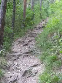 | |||
| surface | paved | unpaved | asphalt | concrete | paving_stones | sett | cobblestone | metal | wood | compacted | fine_gravel | gravel | pebblestone | plastic | grass_paver | grass | dirt | earth | mud | sand | ground | 道路鋪面材質。詳情請見 surface=*。
|
||||
| tactile_paving | yes | no | 是否鋪設導盲磚。 | 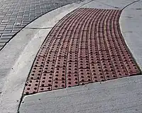 | |||
| tracktype | grade1 | grade2 | grade3 | grade4 | grade5 | To describe the quality of the surface. See Key:tracktype for more information. | 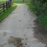 | |||
| traffic_calming | bump | hump | table | island | cushion | yes | etc. | 詳情請見 traffic_calming=*。
|
 | |||
| trail_visibility | excellent | good | intermediate | bad | horrible | no | 標記健行路徑的可識別程度。適用於=path,=footway、=cycleway與=bridleway。
|
 | |||
| trailblazed | yes | no | poles | cairns | symbols | Applies to =*. Describing trail blazing and marking. See Key:trailblazed for more information.
|
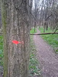 | |||
| trailblazed:visibility | excellent | good | intermediate | bad | horrible | no | Applies to trailblazed=*. A classification for visibility of trailblazing. See Key:trailblazed:visibility for more information.
|
||||
| turn | left | slight_left | through | right | slight_right | merge_to_left | merge_to_right | reverse | The key turn can be used to specify the direction in which a way or a lane will lead. |  | |||
| width | <number> | The width of a feature. |  | |||
| winter_road | yes | 冬季專用的道路,通常於夏季無法行車。 |  | |||
其他功能(Other features) | ||||||
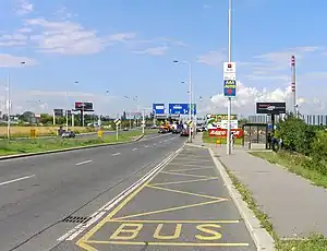
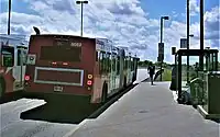
| bus_stop | 公車(巴士)停靠站/站牌。 得使用 public_transport=stop_position嚴格標記公車停靠位置,或以public_transport=platform標記乘客候車的月台。詳情參見public_transport=*。
|
 |
 | |||
| highway | crossing | A.k.a. crosswalk. Pedestrians can cross a street here; e.g., zebra crossing | | |||
| highway | cyclist_waiting_aid | Street furniture for cyclists that are intended to make waiting at esp. traffic lights more comfortable. | 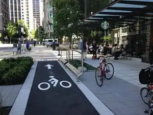 | |||
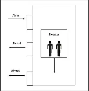
| highway | elevator | 電梯。非手扶梯。 |  |
 | ||
| highway | emergency_bay | An area beside a highway where you can safely stop your car in case of breakdown or emergency. | 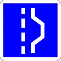 | |||
| highway | emergency_access_point | ,標誌得標定所在位置的特殊編號,供緊急通訊使用,配合 ref=NUMBER_ON_THE_SIGN使用。
|
 | |||
| highway | give_way | 讓道標誌。 |  | |||
| emergency | phone | 緊急電話,配合 ref=NUMBER_ON_THE_SIGN使用。
|
 |
 | ||
| hitchhiking | Like a bus_stop but for free, uncertain, spontaneous rides with strangers. | 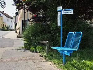 | ||||
| highway | ladder | A vertical or inclined set of steps or rungs intended for climbing or descending of a person with the help of hands. | 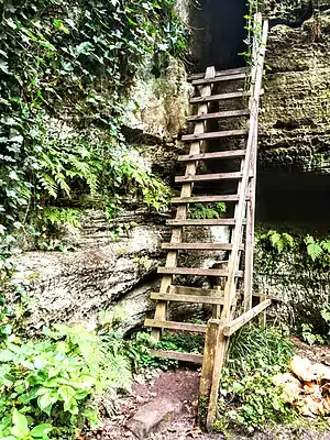 | |||
| highway | milestone | Highway location marker | 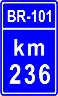 | |||
| highway | mini_roundabout | 無分隔島的小型圓環。 大型圓環請用 junction=roundabout。預設顯示為逆時鐘通行方向,若要使用順時針通行方向請用 direction=clockwise。
|
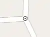 |
 | ||
| highway | motorway_junction | 交流道出口(英國稱為junction,美國稱為exit),使用標籤
|
 |
 | ||
| highway | passing_place | 標記會車路段(避車處)。 | 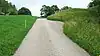 | |||
| highway | platform | 公車站的月台 |  |
 | ||
| highway | rest_area | 休息站:僅供休息,不提供加油服務。 | 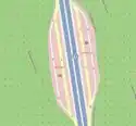 |
 | ||
| highway | services | 服務區:提供食物、加油站與廁所,常見於高速公路。 |  |
 | ||
| highway | speed_camera | 固定式測速相機。 |  | |||
| highway | speed_display | A dynamic electronic sign that displays the speed of the passer-by motorist. | 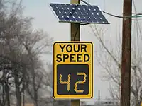 | |||
| highway | stop | 停止標誌/停車再開標誌/「停」處。 |  | |||
| highway | street_lamp | 標示每晚固定開啟的路燈。 |  | |||
| highway | toll_gantry | 電子收費門架是一種立於路徑上的門架(常為高速公路),作為電子收費系統的一部分。收費亭或帶有柵欄的收費亭請參閱barrier。 | .jpg) | |||
| highway | traffic_mirror | 道路反射鏡 | 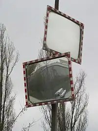 | |||
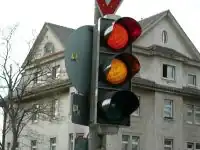
| highway | traffic_signals | 紅綠燈/行車管控號誌/交通燈。 |  |
 | ||
| highway | trailhead | 登山口、步道口:登山健行的步道起點或路線起點。 | 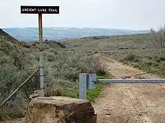 | |||
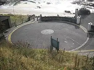
| highway | turning_circle | 迴轉處/掉頭處。通常設於道路盡頭的圓環(迴旋處)或加寬道路,方便車子迴轉(掉頭)。 |  |
 | ||
| highway | turning_loop | A widened area of a highway with a non-traversable island for turning around, often circular and at the end of a road. | 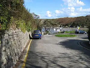 | |||
| highway | 使用者自訂 | 到Taginfo查詢常用標籤值 | ||||

.jpg)

此表格由模版自動生成,協助改善中譯版本請按此。